News
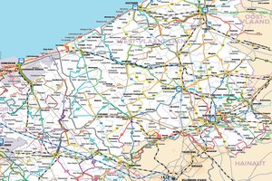
A transport map covering the North of France and West Flanders
March 2014
The West-Vlaanderen/Flandre-Dunkerque-Côte d'Opale EGTC has just published a cross-border public transport map.
Aimed at local inhabitants and tourists, but also at elected representatives as a tool to help decision-making in the area of transportation, it shows the train, bus and tram networks from the South of the Pas-de-Calais department up to the border with the Netherlands, including the Lille conurbation and Belgium as far as Tournai. It comes with a booklet that gives practical information in four languages. More info
Back to list
